← BackWalking guide →
Trip Overview

San Francisco

3 Days · Solo · Balanced
citywalkplan.com
Daily Plan
Day 1
3 Spots
Union Square · Chinatown · Ferry Building
Day 2
3 Spots
Pier 39 · Fisherman's Wharf · Lombard Street
Day 3
3 Spots
Coit Tower · North Beach · Golden Gate Bridge
Trip Notes
The first page gives the full route overview. Each following page breaks the trip into a single-day map and spot cards so it is easy to share, print, or turn into a PDF.
Keep CityWalk Plan Free
Trip planning is free. If this itinerary helps, please consider booking through our partner links to support us.
No extra cost to you. Affiliate URLs can be added later.

Day 1

San Francisco · 3 Spots
1
Union Square
Union Square
Neighborhood · 1.5-2 hours
Union Square is a 2.6-acre (1.1-hectare) public plaza bordered by Geary, Powell, Post, and Stockton Streets in downtown San Francisco, California. "Union Square" also refers to the central shopping, hotel, and theater district surrounding the plaza for several blocks. The area got its name because it was once used for Thomas Starr King rallies and support for the Union Army during the American Civil War, earning its designation as a California Historical Landmark.
NoteThis area works best when you leave room to walk slowly, browse side streets, and stop for coffee or snacks.
Wikipedia →
2
Chinatown
Chinatown
Neighborhood · 1.5-2 hours
Chinatown (Chinese: 唐人街) is a common term used to describe an ethnic enclave of Chinese people located outside of Mainland China, Hong Kong, Macau, and Taiwan, typically situated in an urban area. Chinatowns can be found around the world, including in Europe, Asia, Africa, Oceania, and the Americas. The history of Chinatowns date back to the Tang dynasty in the 10th century, arising from the nation's important role in global trade.
NoteThis area works best when you leave room to walk slowly, browse side streets, and stop for coffee or snacks.
Wikipedia →
3
Ferry Building
Ferry Building
Market · 1-1.5 hours
The San Francisco Ferry Building is a terminal for ferries that travel across the San Francisco Bay, a food hall and an office building. It is located on The Embarcadero in San Francisco, California and is served by Golden Gate Ferry and San Francisco Bay Ferry routes. On top of the building is a 245-foot-tall (75 m) clock tower with four clock dials, each 22 feet (6.7 m) in diameter, which can be seen from Market Street, a main thoroughfare of the city. Designed in 1892 by American architect A.
NoteGo earlier for the freshest food and shorter lines. Some stalls still prefer cash.
Wikipedia →

Day 2

San Francisco · 3 Spots
1
Pier 39
Pier 39
Entertainment · 2-2.5 hours
Pier 39 is a shopping center and popular tourist attraction built on a pier in San Francisco, California. At Pier 39, there are shops, restaurants, a video arcade, street performances, the Aquarium of the Bay, virtual 3D rides, and views of California sea lions hauled out on docks on Pier 39's marina. A two-story carousel is one of the pier's more dominant features, although it is not directly visible from the street and sits towards the end of the pier.
NotePopular experiences often sell out first on weekends and holidays, so advance booking is safer.
Wikipedia →
2
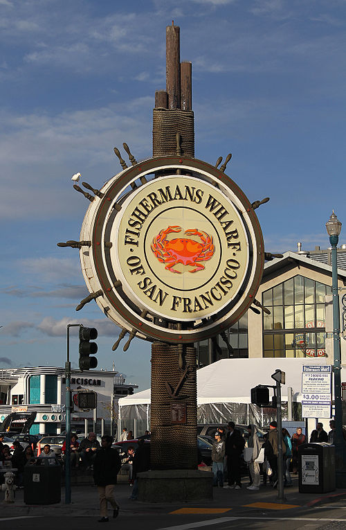
Fisherman's Wharf
Fisherman's Wharf
Neighborhood · 1.5-2 hours
Fisherman's Wharf is a neighborhood and tourist attraction in San Francisco, located in the northern part of the city's waterfront. The Aquatic Park Historic District is often considered to be part of Fisherman's Wharf, though some neighborhood descriptions treat it as a separate area. Historically a working fishing port which also had seafood restaurants that were a draw to outsiders, the fishing docks declined during the 1960s and 1970s while tourist development became dominant.
NoteThis area works best when you leave room to walk slowly, browse side streets, and stop for coffee or snacks.
Wikipedia →
3
Lombard Street
Lombard Street
Landmark · 1-1.5 hours
Lombard Street is an east–west street in San Francisco, California, that is famous for a steep, one-block section with eight hairpin turns. The street stretches from The Presidio east to The Embarcadero (with a gap on Telegraph Hill). Most of Lombard Street's western segment is a major thoroughfare designated as part of U.S. Route 101. The famous one-block section, claimed to be "the crookedest street in the world", is located along the eastern segment in the Russian Hill neighborhood.
NoteAim for early morning or late afternoon light. Popular viewpoints often need timed tickets in peak season.
Wikipedia →

Day 3

San Francisco · 3 Spots
1
Coit Tower
Coit Tower
Landmark · 1-1.5 hours
Coit Tower ( KOYT; also known as Coit Memorial Tower) is a 210-foot (64 m) tower in the Telegraph Hill neighborhood of San Francisco, California, overlooking the city and San Francisco Bay. The tower, in the city's Pioneer Park, was built between 1932 and 1933 using Lillie Hitchcock Coit's bequest to beautify the city of San Francisco. It was added to the National Register of Historic Places on January 29, 2008.
NoteAim for early morning or late afternoon light. Popular viewpoints often need timed tickets in peak season.
Wikipedia →
2
North Beach
North Beach
Neighborhood · 1.5-2 hours
North Beach is a neighborhood in the northeast of San Francisco adjacent to Chinatown, the Financial District, and Russian Hill. The neighborhood is San Francisco's "Little Italy" and has historically been home to a large Italian American population, largely from Northern Italy. It still has many Italian restaurants and a sizeable Italian community, though many other ethnic groups currently live in the neighborhood.
NoteThis area works best when you leave room to walk slowly, browse side streets, and stop for coffee or snacks.
Wikipedia →
3
Golden Gate Bridge
Golden Gate Bridge
Landmark · 1-1.5 hours
The Golden Gate Bridge is a suspension bridge spanning the Golden Gate, the one-mile-wide (1.6 km) strait connecting San Francisco Bay and the Pacific Ocean in California, United States. The structure links San Francisco—the northern tip of the San Francisco Peninsula—to Marin County, carrying both U.S. Route 101 and California State Route 1 across the strait. It also carries pedestrian and bicycle traffic, and is designated as part of U.S. Bicycle Route 95.
NoteAim for early morning or late afternoon light. Popular viewpoints often need timed tickets in peak season.
Wikipedia →